
OysterCatcher Winter 2026

Mangrove surveys complete in Apalachicola Bay
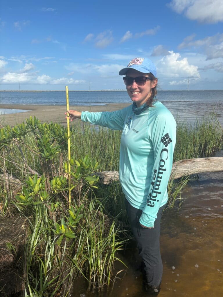
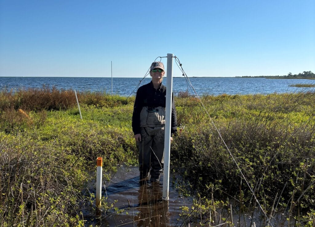
Stewardship staff member Zoe Cross measuring a red mangrove.
Reserve stewardship staff completed annual mangrove surveys this past summer. Apalachicola Bay is home to both black and red mangroves. These mangrove species are highly adapted to salty coastal environments. They can filter the salt out of seawater in various ways. The red mangrove, Rhizophora mangle, excludes salt by filtering it out upon intake at the root, only absorbing the water. The black mangrove, Avicennia germinans, takes in the saltwater and then stores excess salt in its leaves.
Mangroves help to cycle nutrients in the water and provide habitat and protected nursery grounds for a variety of important organisms. They also provide a storm buffer by reducing wave action and wind impacts to shorelines. These tropical species have started to become more common in this area but are limited in their expansion by their sensitivity to subfreezing temperatures.
Reserve staff have been monitoring mangroves yearly since 2018 to monitor the northern range expansion of mangroves through this long-term project. Staff surveyed eight transects spread between St. George Island and Little St. George Island this year. Measurements are taken on tagged mangroves to monitor growth rates, and recruits that emerge along the transects are counted as well.
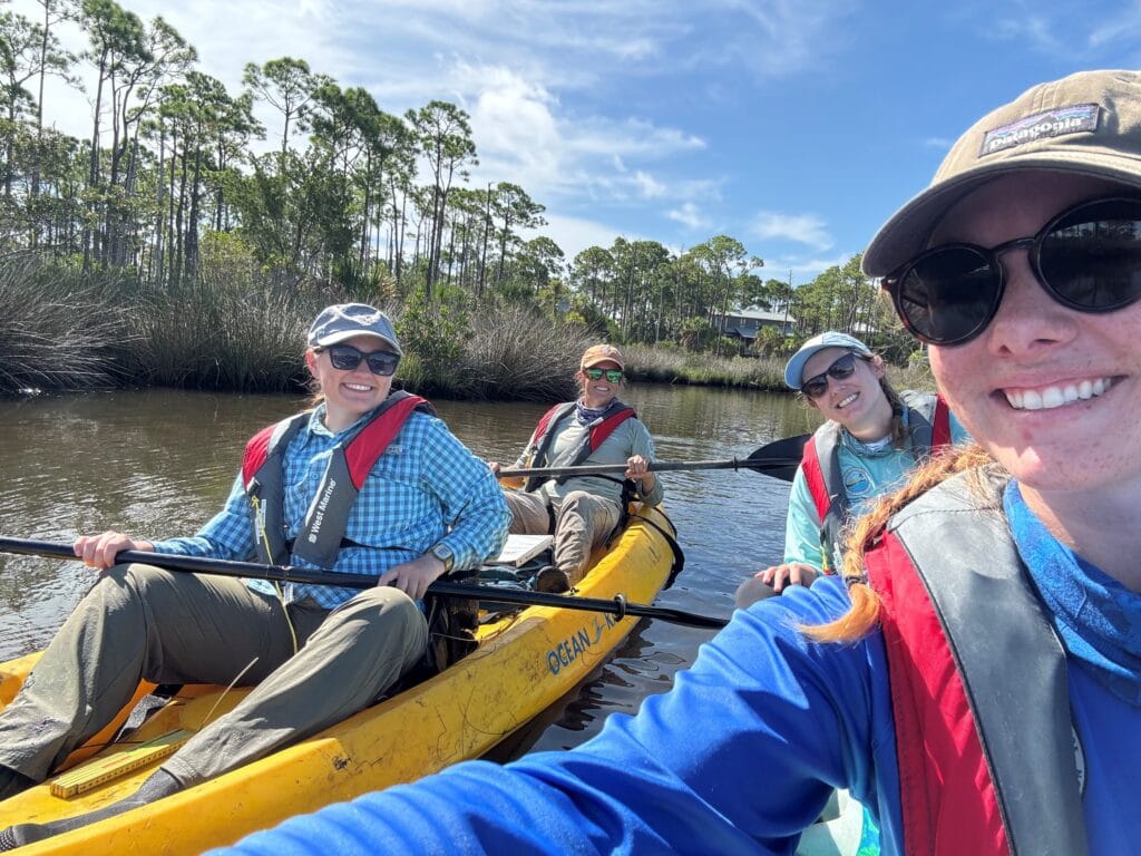
Stewardship team kayaking to the mangrove transect sites.
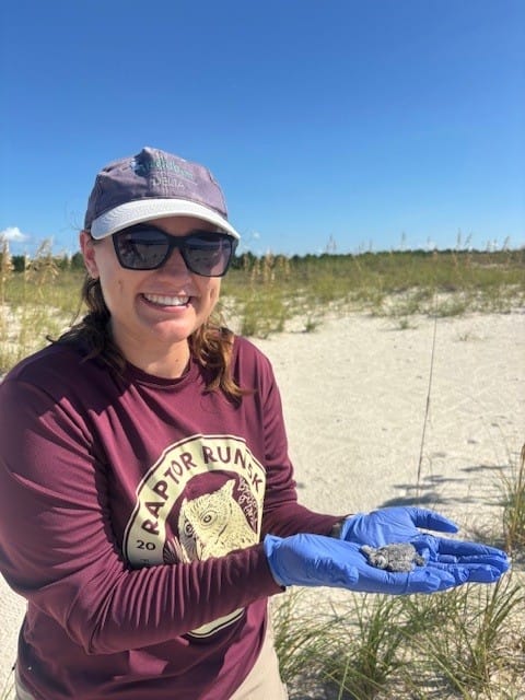
Little St. George Sea Turtle Nesting Update
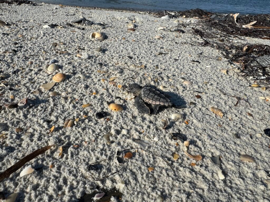
Sea turtle hatchling heading to the water.
Volunteer and staff sea turtle monitoring teams worked hard this summer. Turtle nesting is monitored from May 1st to October 31st, closely overlapping with hurricane season. We were grateful to have a low storm season this year and no hurricane-related monitoring delays or damage to the island. Throughout the summer, surveyors kept an eye out for tracks of nesting turtles. When crawls were found, they were identified as either a nest or false crawl. Nest were marked and then monitored for signs of hatchling emergence. Once hatchlings emerged from a nest, or when enough time had passed, nests were evaluated. During nest evaluations, everything found remaining in the egg chamber was inventoried. The number of empty eggshells found helps estimate how many turtles made it out of the nest.
This year, Little St. George Island had 164 nests and 247 false crawls. Five of the nests on Little St. George Island were from Green Sea Turtles this year, and the rest were Loggerhead Sea Turtles. Nearby, St. George Island had 362 nests and 379 false crawls. St. George Island had 43 Green Sea Turtle nests in 2025, the rest were Loggerhead nests. Carrabelle Beach had 1 nest and 1 false crawl, both from Loggerheads. Overall, it was a good nesting season, and we are looking forward to next year!
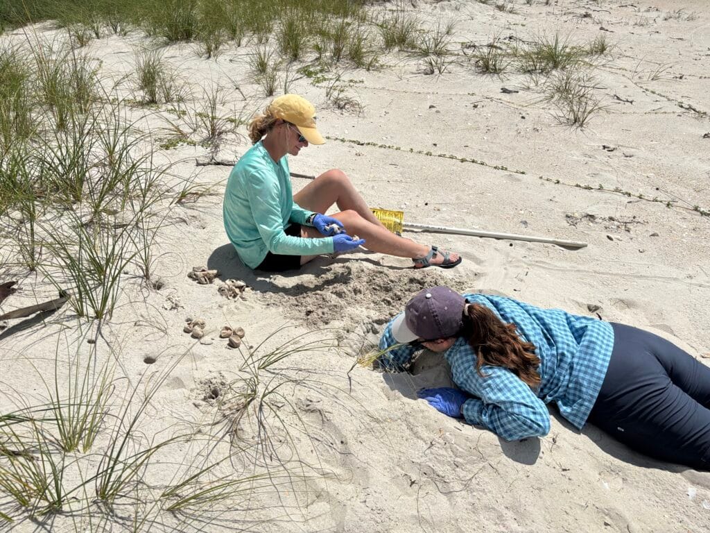
Stewardship team completing a nest inventory on Little St. George Island.
Stewardship Intern
Victoria Germany conducting sea turtle nest inventories.
The Friends of the Reserve (FOR) financially support an intern to work with the stewardship team each year to assist with sea turtle nesting on Little St. George Island and help with other stewardship projects. This year, Victoria Germany joined our team as an intern from May through November after graduating from Eckerd College.
Victoria worked hard on multiple projects throughout her time here. She took the lead on a new sand study this year – collecting and processing multiple sand samples from Little St. George Island. The data she collected will help investigate how the properties of the sand relate to temperature in sea turtle nests. On top of this project, she helped with some of our regular stewardship field work throughout the summer, too – sea turtle surveys, mangrove monitoring, cultural resource monitoring, clearing trails, removing invasive plants, putting up signs, and picking up trash in our managed lands. She also got some opportunities to join our research team to help with their regular trawling and water quality tower maintenance. She got a wide variety of field and lab experience with Reserve! We hope she enjoys a nice break after her busy year. We’ll miss her fun, positive attitude and all of her help! Thanks, Victoria!

Victoria getting stuck in the marsh measuring a mangrove during surveys.
USDA Continues Coastal Zone Soil Survey Work
USDA soil scientists describe soil cores taken from tidal marsh sites.
Research staff continue to collaborate with and assist USDA in their Coastal Zone Soil Survey (CZSS) of the Apalachicola Bay system. The CZSS will be ongoing for the next few years and is broken into three phases, spanning from Indian Pass to Alligator Harbor. The surveys will provide updated soils information for land use and management decisions. Soil maps of swamps, marshes, and bay (subaqueous soils) will be added to the existing data of the area. The collected physical and chemical soil properties will allow data users to better understand changes taking place within the bay and surrounding environment.
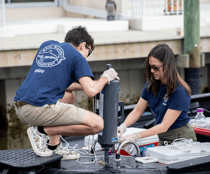
Water Quality Stations Maintained
Reserve research staff were able to complete routine cleaning and maintenance of their five water quality monitoring stations. Over time, the PVC tubes that house our water quality monitoring equipment become biofouled from barnacles, oysters, algae, mud, and more. This can alter the conditions within the tube, creating a microcosm that is not representative of the water surrounding it. To prevent this, as well as to ensure quality data collection, staff dive the stations quarterly to clean, inspect, and perform maintenance on the tubes. Data will now be checked to see if any measurements were altered after being cleaned to see if the tube was impacting the data.
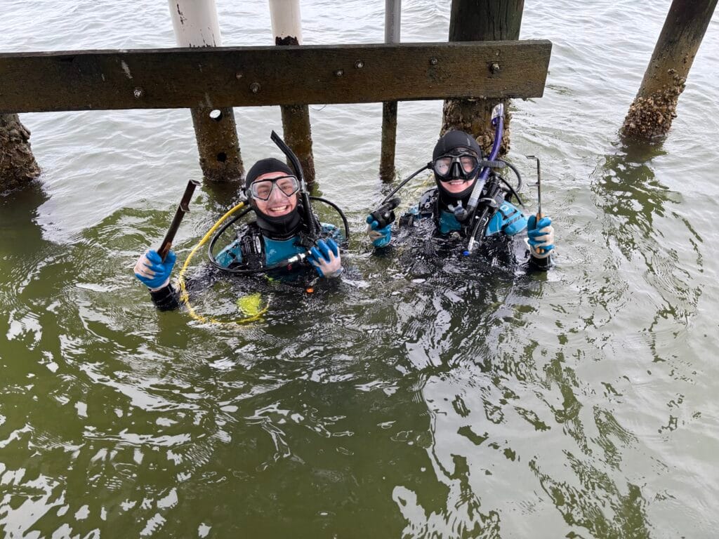
The Reserve Research staff Sam and Michael preparing to clean a water quality station.
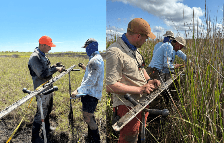
Research Team Takes on Marsh Work
The Reserve Research staff completed their surface elevation table (SET) monitoring for the year. SET monitoring occurs biannually at eleven wetland sites. Each site contains two SET stations where surface elevation measurements are conducted at the four cardinal directions using a device known as a SET arm. Feldspar marker horizons (cores) are also extracted and measured at three locations within each SET. This monitoring project began in 2012 and is designed to describe long-term, spatiotemporal marsh elevation changes.
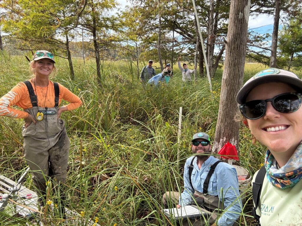
Reserve research staff and FSU’s Breithaupt lab at their last site of the day.
While mucking around in the marsh, staff also exchanged water quality monitoring equipment at three porewater sites. Each site consists of three porewater wells evenly positioned along a vegetation transect. A datalogger is deployed within the well to monitor marsh water quality, specifically water level and conductivity.
The team continues to collaborate with Florida State University and hosted Dr. Josh Breithaupt, PhD student Simone Schuster, and two of their volunteers for a day. As part of her research project, Simone extracted core samples adjacent to our riverine SET sites. Simone will then be using a lead isotope to age the layers within the samples. This will later be compared with the Reserve’s marker horizon data to provide a more detailed look into the soil processes over time. We look forward to continuing to work with the Breithaupt lab!
The Reserve Research staff Stephanie exchanges marsh porewater loggers along a transect.
Third Graders Working to Save the Bay one VOG at a time
Third graders from Franklin County Schools created vertical oyster gardens (VOGs) as part of their annual field trip that focuses on oysters as a keystone species in our bay. These oyster gardens were created with the help of Oyster Corps and their representatives. The class began with a nature journal activity about how detritus from upriver provides nutrients to our bay as well as the importance of oysters as habitat for other creatures. This activity was followed by an oyster lab where students investigated their own miniature oyster bar to investigate and identify all the species they could find in their oyster bar. Students, teachers, and chaperones all really appreciated the new inclusion of the vertical oyster gardens in our existing 3rd grade curriculum. These VOGs will eventually be placed in Apalachicola Bay to assist in providing locations for oyster spat recruitment. A local business with waterfront access has agreed to host these VOGs, that will then be investigated for successful recruitment by one of our new high school field trips within our local county school system. We love tying lessons together across multiple grade levels in our local community and this project conducted in partnership with Oyster Corps will provide another great opportunity to do so.
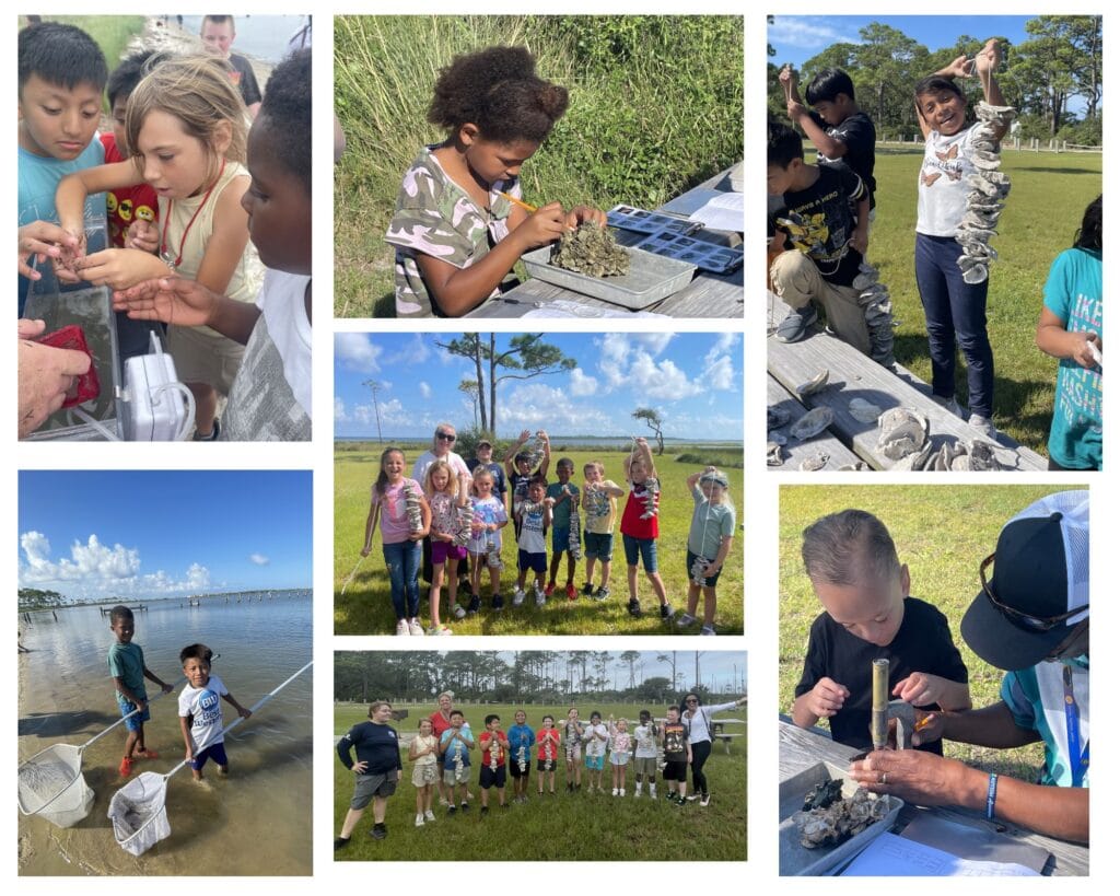
A collage of Franklin County Schools’ students enjoying their days learning about oyster reef habitat with the Reserve staff.
High Schoolers Help Assess 3rd Grader Oyster Garden Success
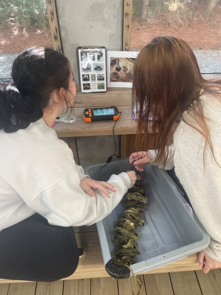
Students evaluating VOG.
Our local Franklin County High School Science students visited the reserve to check on the vertical oyster gardens (VOGs) that our 3 grade students made. These VOGs had been soaking for less than a month from a dock at one of our local waterfront businesses near the reserve. Students looked at the community of critters that they could find on each VOG and count how many of each type of organism they found. Students also recorded the position on the VOG of each oyster spat that they found, which ranged between 2 and 62 spat on each VOG. The average number of spat counted per VOG each day ranged from about 12 to 29 per VOG. When the students were then asked whether they felt the VOGs were a successful tool for oyster spat recruitment, it was a unanimous yes from the crowd. Our new collaboration between OysterCorp, our local community, County 3rd grade and high school students is gaining momentum.
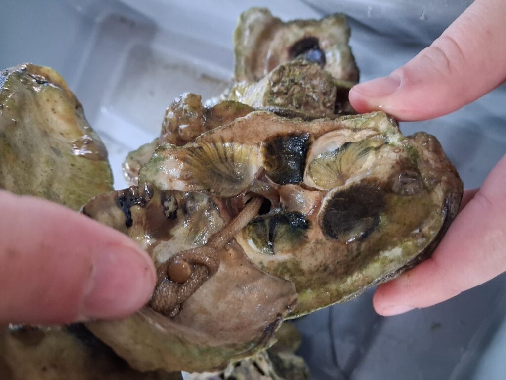
VOG with multiple oyster spat on shell.
Fishy Fashion Collaboration and Celebration
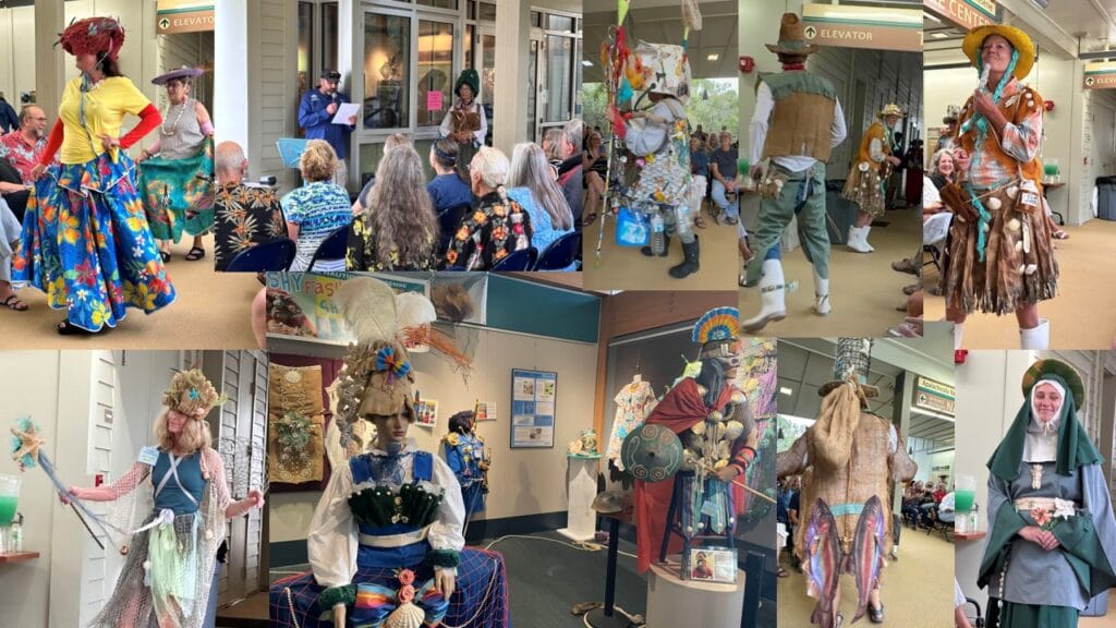
A Collage of the Fishy Fashion Show opening and marine debris exhibit.
The Fishy Fashion Show exhibit and opening night were a mixture of joy, silliness, education, seriousness, and creativity. Artist Joan Matey’s costumes made of marine debris delivered a message both powerful and fun. ANERR staff proved to be quite talented at sashaying and twirling as they modeled some of the costumes that are not featured in the exhibit. The exhibit also features a joint effort with our local Franklin County school students and their incredibly talented art teacher Ms. Lydia Countryman. Ms. Countryman and the students set about creating sculptures, pictures, and various other artistic media made from recycled materials and debris they had found. These works were accompanied by stories that tied in well with Joan’s artistic ambience. Our favorite quote from one of the Franklin County School students’ stories was “From Heron Out represents a promise; a promise that from here on out, we will dedicate ourselves to protecting our fragile and beloved ecosystem.” The exhibit featured some interesting facts about marine debris in hopes of improving awareness and education about this topic in an amazing collaboration involving art, science, education, and our local county school students. The opening fashion show was well attended by over 80 people including many of our student artists.
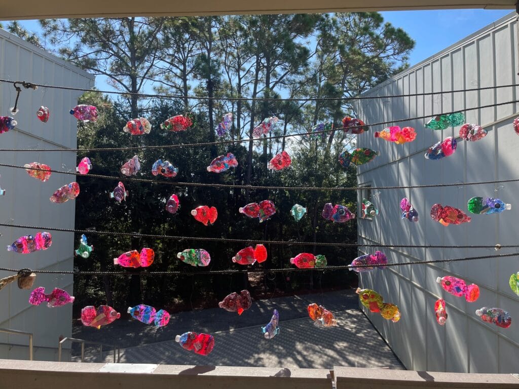
Fishy Water Bottle Art created by Franklin County School 3rd graders.
Sci-Cafe Shellfish, Sulfides, and Soil Carbon: Coastal Zone Soil Survey of Apalachicola Bay
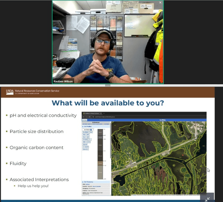
Sci-Café featuring Rueben Wilson with the USDA.
Rueben Wilson with the USDA-NRCS-Soil and Plant Science Division presented at a Sci-Café webinars -Shellfish, Sulfides, and Soil Carbon: Coastal Zone Soil Survey of Apalachicola Bay.
Beginning in the 1990s, the National Cooperative Soil Survey (NCSS) and United States Department of Agriculture’s Natural Resources Conservation Service (USDA-NRCS) began extending these investigations into subaquatic environments to better understand soil properties and how it affects shellfish production, vegetation, and human-driven activities such as dredging. In the Fall of 2024, one of these coastal zone soil surveys (CZSS) began in East Bay with the goal of ultimately mapping wetlands and subaquatic soils in all of Apalachicola Bay, from Alligator Point to Indian Pass.
The survey is a systematic analysis of the subaqueous coastal soils. They conduct an analysis of the physical and chemical properties of soil developing the soil characteristics. They then can create a model for a large area resulting in a map that can aid in developing interpretations for scientists and land managers to better understand the coastal soils.
Fieldwork began fall 2024. Seventy-two core samples of the first 6 feet of soil have been taken from throughout the lower Apalachicola River and Bay. They plan to complete 81 samples. The data they collect includes particle size, carbon, nitrogen content, density, and oxidized PH. The outcomes of the project will be detailed maps of the dominant coastal soils including its characteristics. This will help build the understanding of subaquatic soils and vegetation. In their survey of East Bay, they could see a layer of red bands that were put down around the time of Hurricane Michael!
The survey is slated to be published October 2027 on their website: https://websoilsurvey.nrcs.usda.gov/app/
We host a Sci-Café webinar monthly on a variety of topics. To register for upcoming Sci-Cafes go to our website events calendar at https://www.apalachicolareserve.com/events/. To see past Sci-Cafés go to https://www.apalachicolareserve.com/previous-events/
Collection of Historic and Cultural Resources on State Lands
Collection of Historic and Cultural Resources on State Lands at the Reserve.
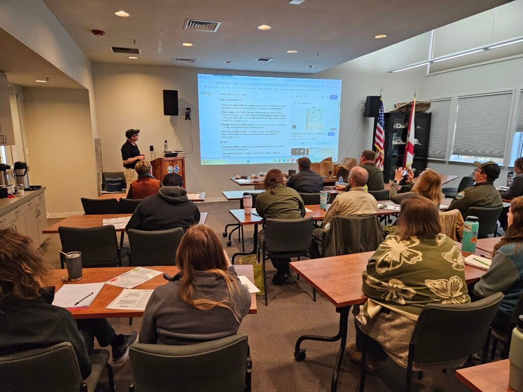
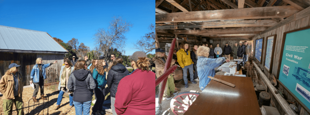
The Reserve’s Training and Engagement Program partnered with the Florida Department of Environmental Protection’s Northeast District Environmental Resources Permitting Office—Carmen Oliverio and Sarah Heuler—to host Collection of Historic and Cultural Resources on State Lands on December 15.
Open to law enforcement, state and local government agencies, and land managers, the training addressed the rules and regulations governing historic and cultural resources located on sovereign submerged lands, as well as the required authorizations for their collection. Participants also received hands-on instruction related to vertebrate fossils, cultural artifacts, and deadhead log specimens.
The training was conducted in two parts: a morning classroom session held at the Reserve, followed by an afternoon off-site historical and archaeological tour at the Orman House State Historic Site.
Twenty participants attended the training, including state land managers and local and state law enforcement officers.
Resource Training at Orman State Historic Site.
New Hires at The Reserve: Alejandra Rios and Svetlana Vikhlyantseva
Alejandra "Ale" Rios joins the Reserve as the new Restoration Coordinator. With her father in the Navy, she always lived on the coast - even briefly in the Gulf. She attended the College of Charleston and completed a Bachelor of Science in Marine Biology. She went on to work on a variety of ecology projects and developed an interest in remote sensing and GIS in conservation. She continued her education at Duke University for a Master's of Environmental Management where she focused on Analytics and Modeling and Coastal and Marine Systems. She hopes to use her past experience and education to contribute meaningfully to the Reserve’s mission.
Svetlana Vikhlyantseva also joined the Reserve as an Environmental Specialist I in the Training and Engagement team. She is a recent graduate from the University of Miami, where she got her bachelor’s is in Marine Affairs and master’s is in Marine Conservation. Born and raised in Aventura, a city in the northern section of the Miami metropolitan area, Svetlana has been a Florida resident her whole life. Growing up near the beaches and nature along the east coast of Florida inspired her passion for marine science from a young age. After beginning her studies at the University of Miami, she became enamored with the world of science communication, education, and outreach. Svetlana hopes that during her time at the Reserve that she will be able to support and improve the current programs and systems for science communication, as well as learn plenty about the local ecosystem and community.
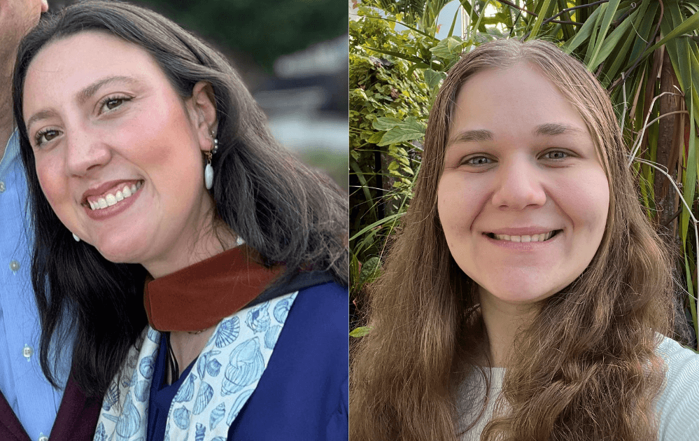
New hires at the Reserve: Alejandra “Ale” Rios (left) and Svetlana Vikhlyantseva (right).
Understanding Red Tide: Effects on Coastal Communities and Strategies for Mitigation
Red tide events pose significant environmental, economic, and public health challenges for Florida’s coastal communities. Join us for a discussion on red tide, its impacts, and current strategies to reduce its effects on coastal waters.
Our featured speaker, Kevin Claridge, Associate Vice President for Sponsored Research and Coastal Policy Programs at Mote Marine Laboratory and Aquarium, will present on January 16 at 2:00 p.m. at the Apalachicola National Estuarine Research Reserve.
Kevin serves as the Mote Administrator for the newly established Florida Red Tide Mitigation and Technology Development Initiative, recently approved by the Florida Legislature and Governor. His responsibilities also include oversight of Mote’s Office of Research Grants, Contracts, and Sponsored Programs, as well as the Mote Marine Policy Institute. Prior to joining Mote, Kevin served as Director of the Office of Resilience and Coastal Protection at the Florida Department of Environmental Protection (FDEP).
The Florida Red Tide Mitigation and Technology Development Initiative is a partnership between Mote Marine Laboratory and the Florida Fish and Wildlife Conservation Commission (FWC). The initiative establishes an independent, coordinated effort among public and private research entities to develop prevention, control, and mitigation technologies aimed at reducing the impacts of red tide on the environment, economy, and quality of life in Florida.
Field testing of red tide mitigation products.
If you miss the talk on Friday, Kevin Claridge will also be presenting at the Friends of St Joseph Bay Preserves annual meeting at the Centennial Building in Port St. Joe at 10:00 am Saturday, January 17th.