
Spring 2020

River Math
By Gibby Conrad, Education Specialist
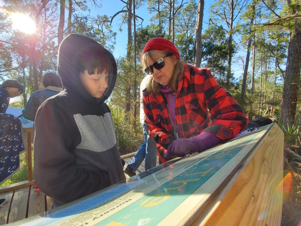
New among the Apalachicola National Estuarine Research Reserve’s exhibits is its Watershed Walk, which runs along the boardwalk connecting the butterfly garden to the bay overlook. Visitors travel downstream from the headwaters of the Chattahoochee and Flint rivers to the mouth of the Apalachicola River where it empties into Apalachicola Bay.
The 270-foot boardwalk is scaled to match the 530 river miles from the headwaters to the bay. Boardwalk markers denoting landmarks such as cities, towns and dams along the river help visitors track their journey.
From its inception the Watershed Walk was intended as a teaching tool for telling the story of the connection between the river system, the watershed and the bay. The idea of a walkable model of the river system scaled at six inches to the mile was used to give visitors an idea of the size of the system. As the project developed, water usage within the watershed and its associated impacts became a focal point of signage on the walk. Explaining water usage required the use of large numbers, percentages, proportional relationships, graphs and other mathematical concepts. We realized that we not only had an ecology-based teaching tool, but a math-based tool as well.
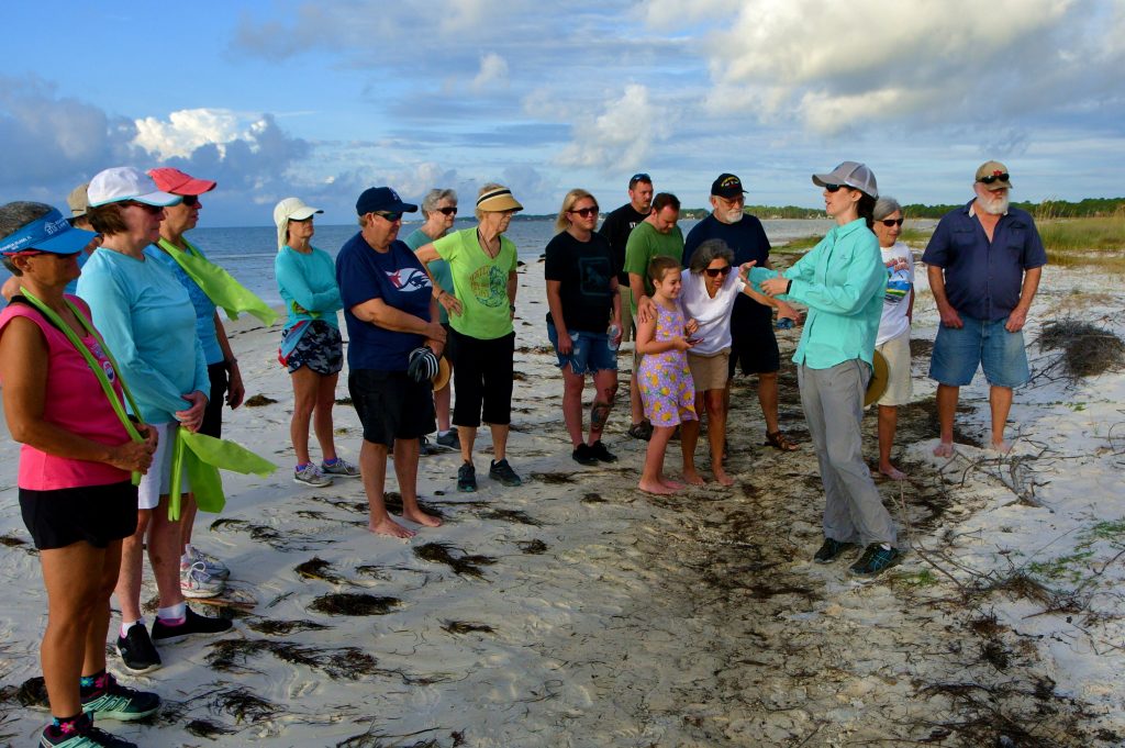
Melanie Humble teaches the TAG (talented and gifted) program at the Franklin County School. The TAG program students are a mixed age group ranging from second grade to high school seniors. From the first time Ms. Humble saw the Watershed Walk, she wanted to use it as an activity for her students. She developed an activity called River Math that is designed to give abstract math problems relevance by relating them to the water usage issues discussed on the Watershed Walk. Because the students must read the signs to solve their math problems, they are also being exposed to the science, geography, sociology and history associated with water usage within the watershed. Math problems presented in River Math run from the basic to the more complex.
An example of a subtraction problem:
How many miles is it from the Chattahoochee headwaters to the Buford Dam?
To solve this problem the student would find the mile marker for the Chattahoochee headwaters (Mile 434) and the mile marker for the Buford Dam (Mile 349) and subtract to find the difference.
Answer: 85 miles
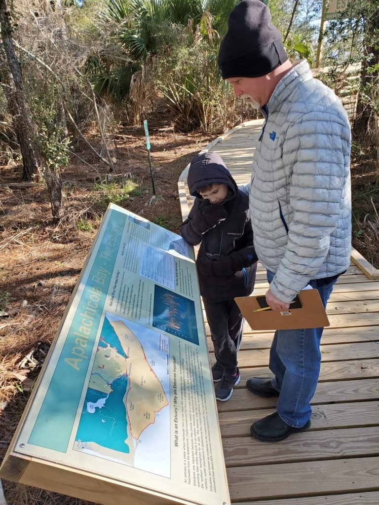
A more advanced question requires reading a graph and interpreting the data:
When looking at the graph showing river flow and bay
salinity, what do you notice about the relationship between
the blue line (river flow) and the orange line (salinity)?
Answer: They are inversely proportionate
What is your hypothesis about this relationship?
Answer: When river flow goes down salinity in the bay will increase.
These questions can lead to a more in depth conversation about what happens to bay ecology when salinity levels increase.
These are just a couple of examples of problems that can be created from the information available on the Watershed Walk. By examining the way students of different age groups in the TAG program were able to handle the questions in Ms. Humble’s River Math activity, the Education staff will be working on age appropriate activities to challenge elementary, middle and high school students to use the signs on the Walk to solve math problems based on real world issues found in our watershed.
Much Done, Much to Do
By Jenna Harper, Reserve Manager
The last year has been very busy for the Research Reserve. Most of the repairs to damage caused by Hurricane Michael have been completed. We hope to have the aquariums back up and running by mid-Spring. We also kicked off our 40th year with a big celebration last Fall. Our Friends group has been supportive of the Reserve in many ways this past year, including assistance in rebuilding our water quality monitoring towers, funding sea turtle nesting interns, supporting special events such as Estuaries Day, and helping us celebrate our awesome volunteers. The Friends have had some big changes as well over the last year, but they remain committed to their mission and the mission of the Reserve.
Last year, we had two directors leave the board of the Friends: the president, Ted Ruffner, and the vice president, Dr. John Sink. Both gentlemen served on the board for many years and dedicated quite a bit of energy volunteering at Reserve events and supporting educational programs. Ted in particular spent many hours sending out member communications, overseeing the finances, completing annual reports, and helping with special events such as the 40th celebration. We will miss both of them very much!
With Ted leaving the board, there was a huge gap to fill. Luckily, our Treasurer, Cathy Franklin, was willing and able to step up and take on Ted’s duties. In addition to many almost day-to-day tasks, the board was also asked to update their MOU with the Department of Environmental Protection. They had to move quickly on this item and they were able to complete the action on time. Kudos go to the other board members too, for stepping up and supporting Cathy through this transitional period. A big thank you to Shaun Donahoe, Erik Lovestrand, and Doug Jimerson!
In December, the board considered several people to fill the open positions and in January, the board voted to ask three people to join the board. The three new members are Susan Mackin, Dr. Lynn Wilder, and Dr. Tom Dolan. These three have very different backgrounds, however each of them has demonstrated a commitment to the preservation and conservation of the Apalachicola River and Bay System, through their ongoing volunteerism and activism. We are very excited to have them join us!
Although there have been many changes recently, and with change there can be challenges, there are also some exciting opportunities ahead. I look forward to working closely with the Friends of the Reserve to further research, education and stewardship at the Reserve and beyond.
Improving Resiliency
Resources for addressing possible risks prior to an event
By Anita Grove, CTP Coordinator
Resilience refers to the capacity of individuals, communities, businesses, institutions and systems to sustain, improve and grow regardless of what kind of chronic stress or acute shocks they experience. Resilience can be significantly improved by identifying possible risks and vulnerabilities, then developing a plan to address them before an event occurs. As we have recently experienced, flooding and wind from storms can be major threats in our area as are wildfires. Understanding how these events can affect your property enables property owners to address them before they occur.
Flooding – Flooding is the most common and most expensive natural disaster in the United States and more than 20 percent of all flood claims come from properties outside high-risk flood zones. Flooding can be caused by coastal storms and from intense rain events that overwhelm municipal stormwater systems. To help property owners evaluate their risk the Federal Emergency Management Agency (FEMA) publishes maps indicating flood hazard areas and the degree of risk in those areas. The Flood Insurance Rate Maps (FIRM) are divided into zones: Moderate/Low Risk (Non-Special Flood Hazard Area); Zones B, C, X High Risk (Special Flood Hazard Area) Zones A (A, AE, AH, AO) Zones V (V, VE). Further information on flood zones can be found at https://www.fema.gov/flood-zones. Homeowners and renters insurance do not typically cover damage related to flooding. FEMA’s FloodSmart. gov site has information on purchasing flood insurance and measures to take before, during and after a flood to help protect yourself and your belongings. The Franklin County Floodplain Administrator website lists helpful steps property owners can take to address flooding, and has a resource list on their main page. The City of Apalachicola also has FEMA flood maps on their website.
Wind – Wind is another force to consider that impacts local properties. The Florida Department of Emergency Management website details steps that can be taken to strengthen existing buildings. Homes built before 1990 can greatly benefit from the addition of hurricane clips that tie the roof and walls to the foundation as well as hurricane shutters for windows and doors. The Homeowners Handbook to Prepare for Natural Disasters is a good resource written specifically for homeowners to help reduce the risks from natural hazards. It covers basic information on emergency preparedness, evacuation planning, flood/wind insurance, and steps to take to protect your property such as retrofitting your roof, your doors and windows.
Wildfire – Franklin County is surrounded by large tracts of forest land and natural areas. Wildfire should also be considered when looking at possible threats to your property. The Florida Forest Service’s Firewise website has tips on reducing fuels around your property to reduce your risk. The site also has a Hazard and Wildfire Risk Assessment Scoresheet to help evaluate your risk.
Enhancing community resilience is a priority for NOAA, our federal partner, and for the Department of Environmental Protection, our state partner, and a goal at the Reserve. Addressing and mitigating your risks before a disaster can greatly increase your chances of reducing damage. Whether it is purchasing flood insurance or retrofitting your roof, taking steps to improve your property does increase your resilience which increases the community’s resilience.
A Rare Appearance
Loggerhead sea turtle nests at McKissack Beach
By Caitlin Snyder
This summer, two loggerhead sea turtle nests were laid at McKissack Beach in Carrabelle. The loggerhead is one of the federally and state listed threatened sea turtle species monitored annually by permitted surveyors across Florida.
You might be wondering what the big deal is about just two turtle nests along a Florida beach. Sea turtles don’t often land in Carrabelle to lay their nests. In fact, from 1996 to 2018, there have been only five observed loggerhead nests and three crawls (nesting attempt with no eggs deposited) in the Carrabelle Beach area. This is due to Carrabelle being shielded by the barrier islands and not located directly on the Gulf where most sea turtles nest.
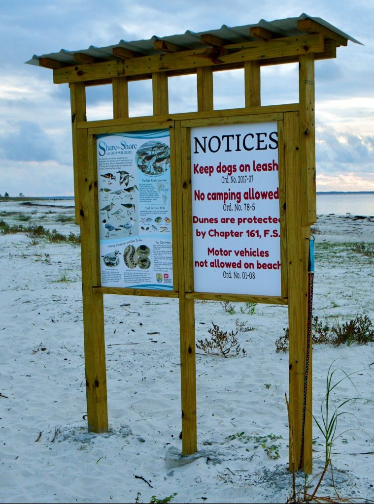
Local residents alerted staff at the Reserve when they came across the nests during their daily beach walks in July and August. Stewardship staff verified the nests and installed FWC turtle signs and self-releasing wire screens to encourage awareness and to protect the eggs.
McKissack Beach, or Carrabelle Beach, is a 300 acre property owned by the Florida Department of Environmental Protection (DEP) and leased by the City of Carrabelle. It is a beautiful example of intertidal marshes, beaches and dunes, and is popular among locals and visitors alike for walking, swimming, and wildlife observation. Historically, vehicular traffic on the beach has been an issue both concerning to local residents and negatively impacting the pristine beach habitat. By county ordinance, dogs must be kept on leash, camping is prohibited, and motor vehicles are not allowed. In alte summer community residents encouraged the City of Carrabelle to install posts and signage at the Gulf Beach Drive after tire tracks were observed near the sea turtle nests on more than one occasion. FWC law enforcement and the Franklin County Sheriff’s Office routinely patrol beach access points and enforce the county ordinances. Residents worked with the City of Carrabelle, FWC, Audubon Florida and US Fish and Wildlife Service to develop a kiosk which provides education about beach wildlife and conservation issues while reminding beach goers of local ordinances in place to safeguard the area.
Adult female turtles face many challenges as they nest on our public beaches, such as entanglement in beach furniture, disturbance by animals, and disorientation from artificial lighting. Once laid, eggs endure 50-70 days of incubation and can be damaged by illegal vehicular traffic on the beach, tides, ghost crab predation, and washouts from tropical systems. Both native and nuisance wildlife, and even dogs, can snatch hatchling turtles as they emerge from the sand on their way to the water. Only one in 1,000 hatchlings makes it to adulthood. Every nest matters.
Nest evaluation by permit holders takes place generally 70 days from when they were laid. Determining hatch success helps land managers to better manage the site in favor of successful turtle nesting. Local data contributes to a statewide FWC database that tracks long term populations of sea turtle species.
Seventeen residents joined two staff from ANERR on one mid-October morning to perform nest evaluations of the two nests on Carrabelle Beach. Residents gathered around as staff excavated the nests and counted hatched and unhatched eggs. Unfortunately, all 71 eggs were unhatched from the July nest. Three hatchlings emerged, however, from the August nest, which had about 95 eggs in total. Inundation from tides and a high water table may have been factors in the eggs not fully developing. Other variables that impact development include temperature, humidity, depth, and physical disturbance. Luckily, sea turtles had a successful year nesting on other area beaches. For example, St. George Island recorded 459 nests (434 loggerhead and 25 green turtles) and Little St. George Island 201 nests (one leatherback, 198 loggerhead, and two green).
Wilson’s plovers, a species of special concern, also utilize the quiet sandy beaches of McKissack to nests. They make a small scrape in the sand to lay their eggs in the open beach, under vegetation, or among rocks or shells. American oystercatcher, black skimmerer, little blue heron, snowy plover, piping plover, red knot, marbled godwit and least tern are other protected bird species regularly observed on site. Sea oats and two state listed plants, Godfreys blazing star and large-leaved jointweed, are also in the area and protected.
The McKissack property will soon have a land management plan with the help of the Apalachee Regional Planning Council, DEP’s Division of State Lands, and the City of Carrabelle. Input from various stakeholders in the planning committee will include FWC, DEP, Audubon, residents and conservation advocates. The management plan will advise how to enhance public access and aesthetics at the site while conserving the native habitats and wildlife species. Strategies will focus on restoration of natural communities, improvement of water quality due to nonpoint pollution sources, support of native and protected species utilizing the property, and stabilization of the beach and dune structure and vegetation. Low-impact recreation opportunities, interpretive signage, parking area and drainage enhancements, dune barriers, garbage containment, and ADA accessibility will also be discussed and addressed in the management plan and public meetings. Workshops and public meetings were conducted in February.
Thanks to the local residents and the City of Carrabelle for being true stewards in the community and contributing to the protection of the shorebirds, sea turtles, and the unique coastal habitats at McKissack Beach.
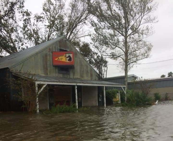
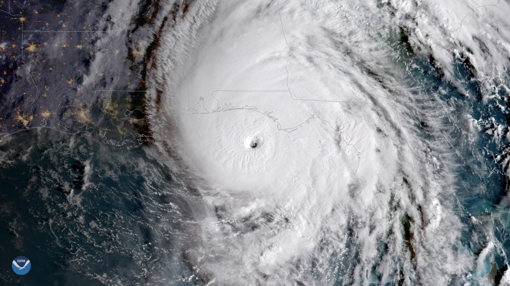
Michael Slams Monitoring Efforts
Data uncollected is data lost forever
By Jason Garwood, Research Coordinator
Although the impacts of Hurricane Michael on the Apalachicola Estuary were relatively short lived, our community, including the Reserve, is still very much involved in the recovery phase. For staff at ANERR, resilience has been a priority in that recovery. The Research Section incurred substantial damage to its monitoring infrastructure. We experienced complete loss of our system-wide monitoring program meteorological station and two of our five water quality stations (Dry Bar and East Bay), which also housed meteorological equipment. Not only is the monetary value of these stations and equipment extremely high, but the intrinsic value of data that are lost forever cannot be valued in the material sense. Therefore, with resilience in mind, Research staff took the opportunity to reflect on what may have caused some of these losses, and what may have kept others from being destroyed.
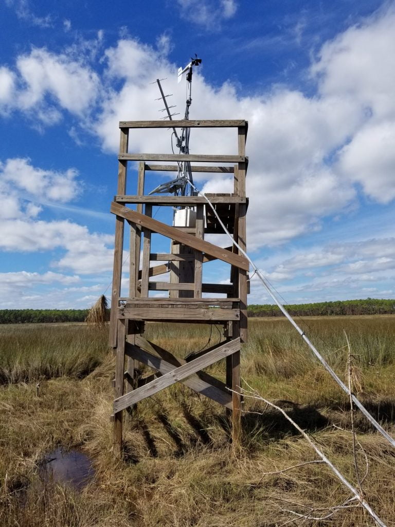
System-wide meteorology station 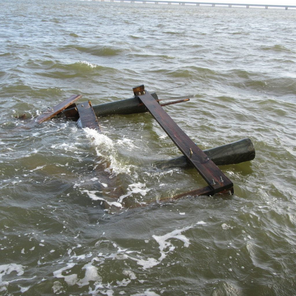
Dry Bar water quality station 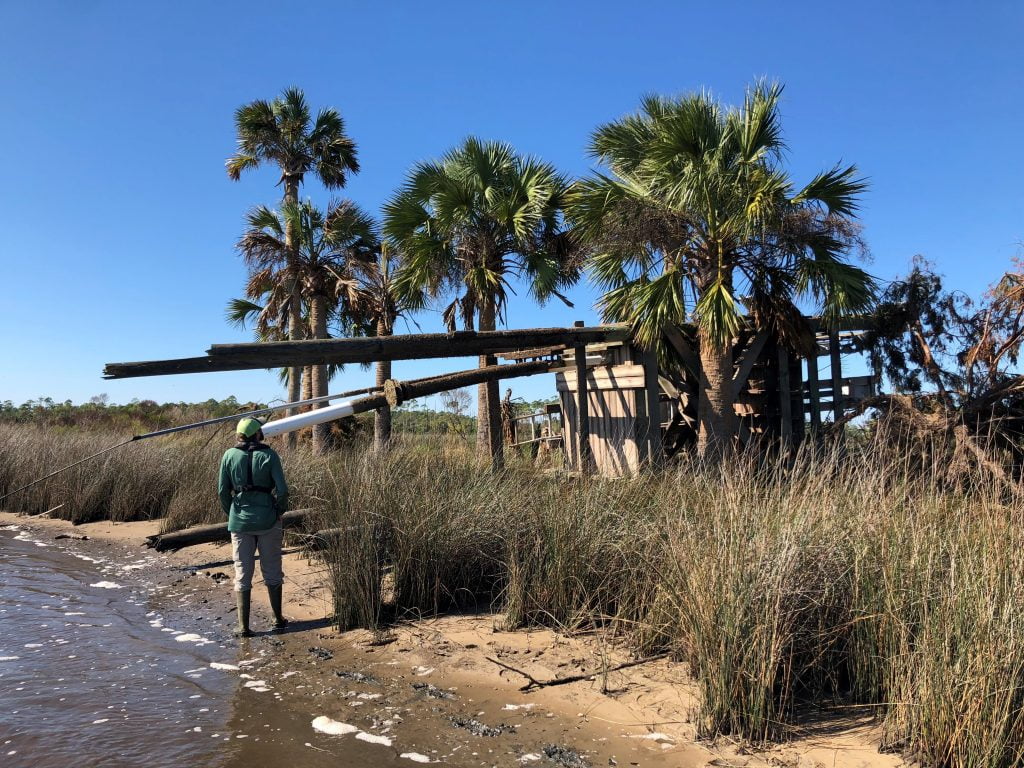
East Bay water quality station
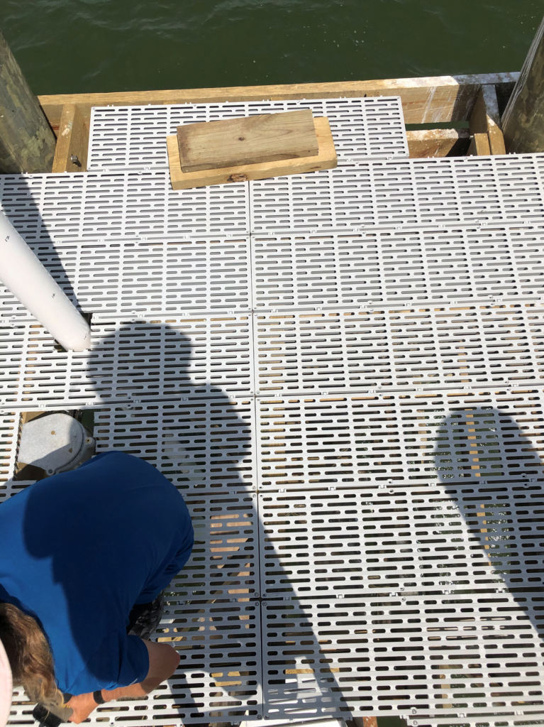
There were notable differences in structural components of the stations that fell as opposed to those that survived the storm. For example, both Dry Bar and East Bay stations were built with two wooden platforms, one upper and one lower. We believe that these wooden platforms, particularly the bottom ones, caused the towers to behave like top-heavy bobbers causing the storm surge and wind forces to uproot the stations. To remedy this problem, we have integrated Thruflow decking, which will allow water to rise around the station without pushing upward on the structure. This material has been incorporated into the new Cat Point Tower that was recently completed this summer and is planned to be used on East Bay and Dry Bar towers that are currently under reconstruction. We have also added new solar powered navigation lanterns to all of our existing towers. Each new tower will be outfitted with these as well. We anticipate the completion of East Bay and Dry Bar stations by the end of winter 2020.
More resilient construction on our new research stations 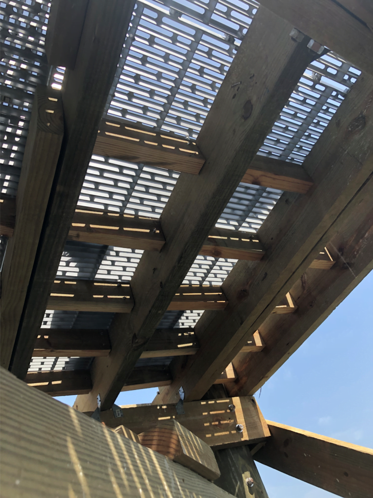
Thruflow flooring to help with storm surge 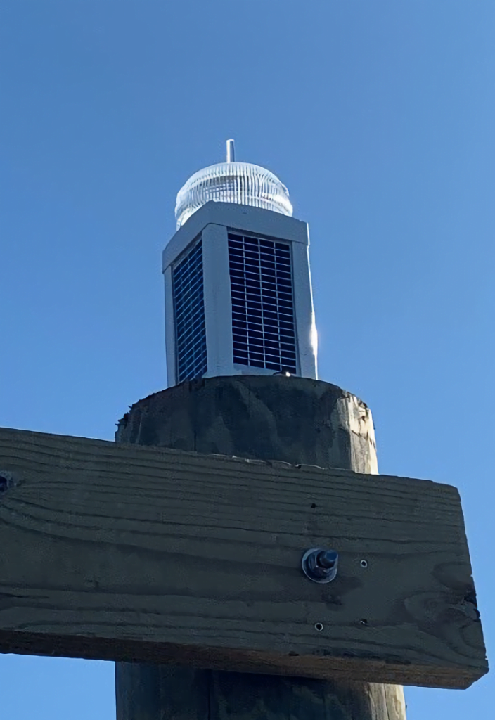
New highly visible marine navigation lights
We decided to move the location of our system-wide meteorological station from the East Bay marsh over to the dock at our maintenance facility. The location of the station made access difficult on short notice, mainly because of weather and tides. We had also had issues with prescribed fire at the old location. We received approval from our Centralized Data Management Office in spring 2019 and have since completed reconstruction of the station. We’re currently collecting near real-time data, which is available online.
We’re hoping for a long stretch of time before we endure another significant weather event like Michael, but we are always assuming one could be just around the corner. Hopefully these changes will help us become more resilient when the next event does occur.