OysterCatcher Winter 2022-2023
Fostering Lifelong Relationships
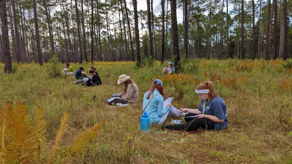
Students gain a deeper appreciation of their ability to thoughtfully observe the natural world in a way that fosters a lifelong relationship with the environment.
Education – Melanie Humble, Education Specialist
The only sounds in the marsh came from birds, the breeze and gently lapping water. On the boat that morning students and teachers from Ed Corps High School and staff from the Reserve’s education section intensely focused on drawing the scene before them. They used their journals as tools to capture the wonder, mystery and magic of our watershed.
On another day, the same scene unfolded in the longleaf flatwoods of the Apalachicola National Forest; where students and teachers drew the myriad of herbs and wildflowers that thrive in the natural balance of a fire dependent system.
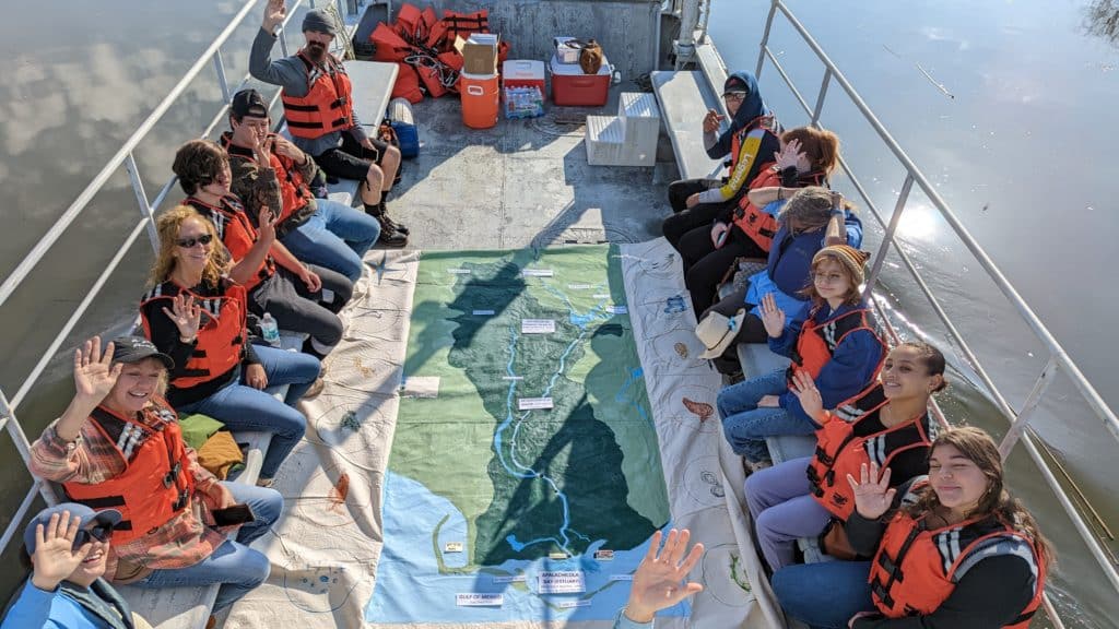
Our outdoor classrooms have included an exploration of the living shoreline at the Reserve, seagrass trips at the FSU Coastal and Marine Lab, Little St. George, and Fort Gadsden.
The Ed Corps High School, led by their experienced and inspirational administrator, Elinor Mount-Simmons, was created to provide an individualized, project-based and flexible learning environment, a student -centered school. The education section of the Reserve has partnered with the school this year to enhance their science curriculum and to provide experiences of the estuarine system that empower the students to become stewards of their own environment. This partnership has also functioned as a lab school for the education staff at the reserve. With the Ed Corps students and teachers, the Reserve staff has been able to explore new methods of teaching over time which is not always possible with single school field trips. The exchange has been mutually beneficial and inspiring. In the words of Ms. Mount-Simmons, “Our partnership with ANERR has been an important part of Ed Corps High School's academic offerings this first semester and I thank you all for joining forces with us to provide our students a quality education. Your projects have introduced ECHS students to wonderful learning opportunities, exposing them to a curriculum they will remember for many years to come. Please know that the ECHS Family is proud to be aligned with the ANERR staff and look forward to our partnership continuing for years to come."
Our outdoor classrooms have included an exploration of the living shoreline at the Reserve, seagrass trips at the FSU Coastal and Marine Lab, Little St. George, and Fort Gadsden. At each site, nature journaling has been used as a method to closely observe the environment. John Muir Laws is an award-winning scientist, educator, and artist whose strategies for keeping a nature journal guide the Education Section. After drawing or diagramming the subject matter, students respond to the prompt “I wonder…” and write down questions that arise from their observations. After this, they write down a response to the prompt “This reminds me of…” which allows them to make connections to other disciplines and experiences. The education staff and the Ed Corps teachers: Science teacher, Chris Olsted; Bonnie Kellogg, and Linda Gibson participate in the nature journaling alongside the students. This fosters a genuine community of learners who can discuss both the environmental science questions that arise and the merits of using the nature journal methodology itself. The lessons learned after these discussions then inform the education section when leading field trips with other schools.
The Spring semester will include trips to Torreya State Park and implementation of a student designed experiment with periwinkle snails and the living shoreline, as well as further study of oysters in the wild and in cultivation. The naturalist Carolyn Duckworth wrote, “With just paper and pen, people who are passionate about a place may be as well-equipped as anyone to protect it.” With this idea in mind, coupled with E. O. Wilson’s philosophy that “Hands-on experience at the critical time, not systematic knowledge, is what counts in the making of a naturalist”. If students leave this partnership with a deeper appreciation of their ability to thoughtfully observe the natural world in a way that fosters a lifelong relationship with the environment, this year will have been a success.
Change is the Constant
By Jenna Harper, Reserve Manager
I’ll be the first to admit that I don’t like change. I like my routine and my comfort zone where I know what to expect. But living on the coast of Florida has taught me to expect change, whether it’s the constant fluctuations of the tides, or dramatic changes we see with severe storms. There are also the slow, almost imperceptible impacts of climate change that may take years to recognize. Estuaries in themselves are dynamic, ever-changing systems and because of that, the inhabitants of the river and bay are able to tolerate a wide range of conditions. So, as biologists and natural resource managers, how do we track all of these changes to understand the implications for our future environment?
At the Reserve we have several monitoring programs to track important species, habitats and processes. Some are only implemented at the Reserve while others are part of larger state or federal efforts. In this edition of the Oystercatcher is our contribution to the annual sea turtle nesting database; an effort which has been going on since the 1980’s. As you can see from the data, we continue to have strong nesting numbers and the population appears to be healthy, a positive change due to conservation measures. Monitoring all of the aquatic species within the estuary would be impossible, but with a new methodology – using environmental DNA or eDNA – researchers at the Reserve are refining the techniques to identify species utilizing only water samples. This method uses the DNA left behind in the water to identify which species have been there.
Tracking our changing landscape is an important part of understanding what future conditions may be. Through our Habitat Mapping and Change Plan, we have been able to describe the important natural communities within the Reserve. We are working on the second iteration of the map, which will measure gains and losses over the last ten years or so. As part of the mapping effort, we are working with outside researchers to utilize more remote sensing to characterize habitat change. One researcher is our new Margaret Davidson Fellow Jenny Bueno, who is using historic aerial imagery and Unmanned Aircraft Systems (UAS) technology to track the expansion of mangroves within the Reserve.
Not to forget one of the most important inhabitants of the estuarine system – people – the Reserve interacts with thousands every year to communicate the importance of protecting this special place. Education is a vital component in learning to appreciate our surroundings. Our Pre-K through 12th grade educational programs target the youth of our community, and our Stewardship Series is intended to reach our adult populations. We hope that a better understanding of our estuary, and increased appreciation, will lead to behavior change and more-informed decision making. Ultimately, we hope this will lead to improved protection of Apalachicola River and Bay.
Reserve’s CTP Offers Courses
Stewardship Classes for Residents
The Reserve’s Coastal Training Program (CTP) works with coastal decision makers and land managers to offer resources and bridge gaps between science, policy and management to increase collaboration among local, state, and federal officials, institutions and community groups to help preserve our coastal resources. We also offer 5 courses designed to help residents increase their understanding of the ecological connections in this special place.
Apalachicola River and Floodplain
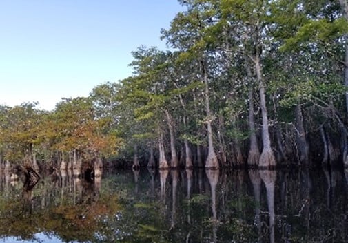
The Apalachicola River is the largest river in Florida in terms of flow, 16 billion gallons per day historically. Learn about the ecology, culture, and history of the Apalachicola River and floodplain, and the impacts interstate relationships play in the control of the river. After the in-class portion, we will embark on a journey up the river aboard the Reserve’s research vessel to get a look at some of the floodplain ecosystems.
Estuary Exploration
The Apalachicola River and Bay come together to form one of the least polluted, most undeveloped, resource rich systems left in the U.S. Learn how these ecosystems are intricately connected, and about the life this rich estuary supports. We will take a trip down a portion of the river and then across the Apalachicola Bay to Cape St. George aboard the Reserve’s research vessel. While on Cape St. George we will explore and learn about the history and ecological role this barrier island plays in the estuary.
Oysters
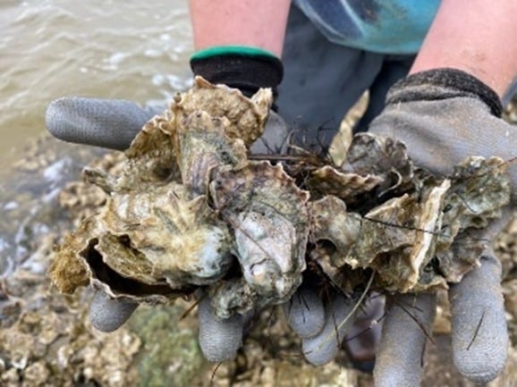
Learn about the role oysters play in the health of Apalachicola Bay. Discover what makes the bay ideal for growing them, how oyster bars benefit the ecosystem and what gives our oysters their distinct flavor. We will also discuss what is being done to restore the oyster reefs and other projects planned to address water flow.
Apalachicola River and Floodplain
Oysters
Bay-Friendly Landscaping
Living Shorelines for Homeowners
Bay-Friendly Landscaping
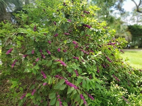
Our soil and weather conditions make landscaping and gardening tough. Success lies in good design and informed plant selection. In this class we will help you find resources to create a yard that is easier to maintain and share resources about plants do well in our sandy soil. We also look innovative green techniques such as rain gardens and plants that provide food for wildlife. Come find out how to be good to the bay and reduce the time you spend on maintenance!
Living Shorelines for Homeowners
Living shorelines are effective solutions for reducing shoreline erosion and this was demonstrated during Hurricane Michael. Join us to learn about the causes of shoreline erosion, methods of controlling it, permitting, and factors to consider when thinking about installing a living shoreline. We will tour some area examples of living shorelines.
Sign up
The Stewardship Series classes are offered monthly and reservations are required. All classes are free, however there is a $25 refundable deposit to reserve a seat for some classes. The deposit will be refunded if you attended the class. To sign up go to https://www.apalachicolareserve.com/events/ For further information, please email Anita Grove Anita.Grove@FloridaDep.gov or Alicia Bruno Alicia.Bruno@FloridaDep.gov.
Habitat Mapping & Change Plan Updates:
Recording Change Over Time Recording Change Over Time within Estuarine Systems
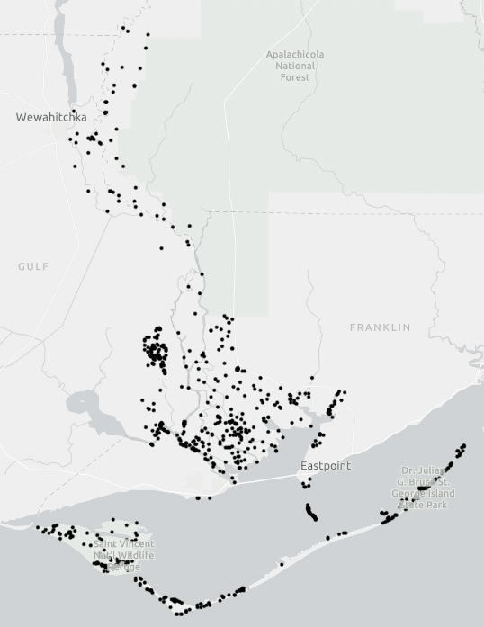
This image shows the 716 ground-truthing points the Stewardship team will visit to complete the accuracy assessment portion of the project.
This summer marked the beginning of work on the updated NOAA Habitat Mapping & Change (HMP) Plan for the Apalachicola National Estuarine Research Reserve. The ANERR Stewardship team is in the midst of completing ANERR’s updates to this nation-wide effort to map habitats and habitat change in coastal ecosystems. The Reserve System’s HMC Plan was first developed in 2007 to establish the framework for mapping habitats in reserves for long-term change related to local sea level change and human-caused stress from Reserve watersheds. Every 10 years, all Reserves complete an updated habitat map and undergo a change analysis in comparison to previous maps. ANERR’s first HMC Plan was completed in 2010, and this year we have begun working with NOAA to update this mapping effort across the Reserve’s 235,000 acres.
The goals of the HMC project are two-fold: 1) To develop a framework for mapping habitats and reserve and watershed boundaries to characterize and communicate – at site, regional, and system-wide scales – short-term variability and long-term trends in the spatial changes in reserve habitats, and 2) examine the impacts of climate change, land use within adjacent watersheds, and changes in local water-level and inundation patterns on reserve habitats. Therefore the HMC Project objectives are to map land cover, land use, and associated land cover changes in Reserves and their watersheds; and enhance capacity in the NERRs to map, model, and disseminate information on estuarine habitat trends, and associate linkages with anthropogenic and climatic stressors.
To accomplish this mapping, ANERR staff are working with NOAA to combine a variety of survey techniques including using high resolution aerial maps in combination with ground surveys to categorize land cover into habitat types utilizing a standardized Land Cover Classification system. This means many field days! ANERR has selected 716 location points to visit within the reserve and visually validate the habitat types present. These points were selected randomly, and are distributed to represent all habitat types found within ANERR. The Reserve is vast, and with so many undeveloped remote places some are difficult to visit. To make it a little easier, we further filtered points to be within 100 meters of roads or 200 meters of navigable waterways which gave us our final list of ground-truthing locations. To date we have visited just over half of these locations, which has involved many types of conveyance (4WD truck, UTVs, motor vessels, kayaks), and a wide variety of footwear: mud boots, snake boots, work boots, waders, sandals, and sneakers! Staff have also encountered a variety of wildlife in our surveys, including encounters with feral hogs, snakes, raptors, toads, butterflies, wildflowers, and more. Visiting these remote areas of the Reserve remind us of the unique habitats and species that call this place home, and how special ANERR really is!
We anticipate completing the field component by spring 2023 and a completed change later in 2023. NOAA will take the data validation and create a new habitat classification map for public use. Future restoration and research decisions will be made based on the new classification map, and how significantly the habitats have changed over the last decade.
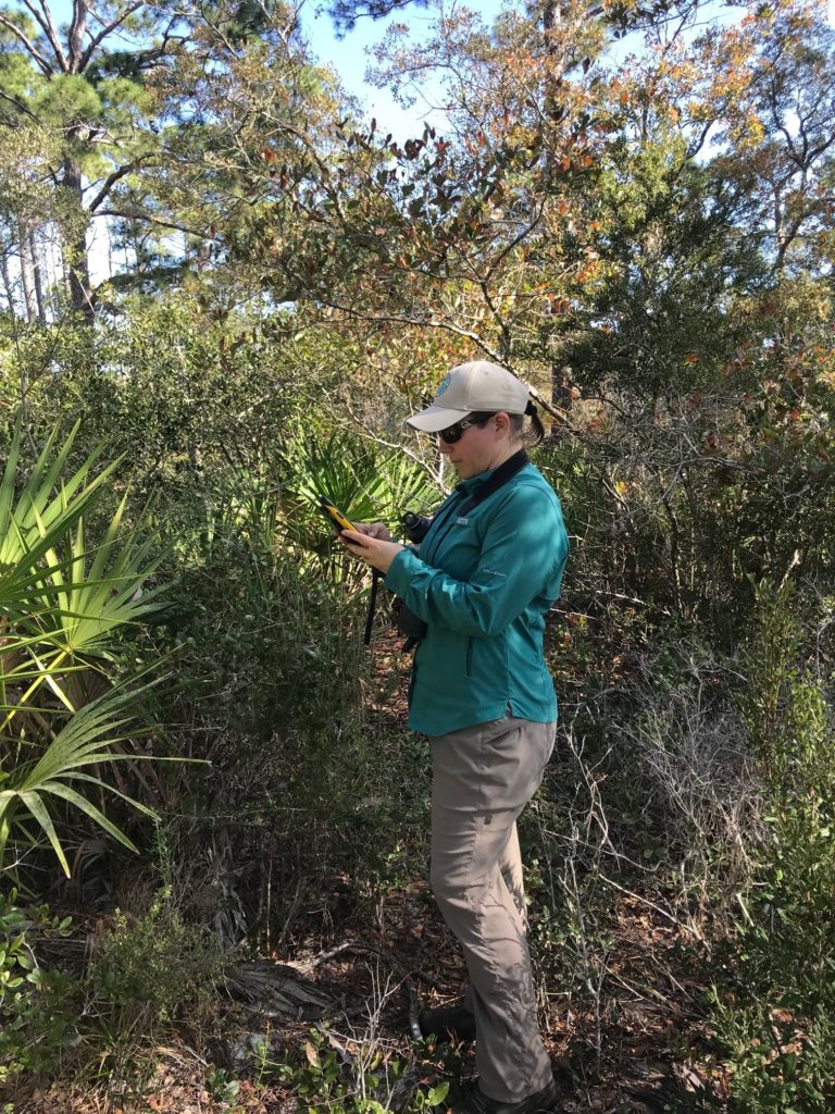
When collecting Accuracy Assessment data, Stewardship staff record habitat class and sub-class information in a Trimble tablet, and take photos of the location that can be used to verify habitat classifications or change in the future.
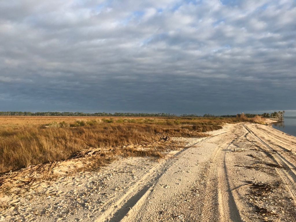
Habitat types. As part of the ground-truthing Stewardship staff were lucky to visit St. Vincent Island and saw Tahiti Beach, beautiful marshes, and hammocks on the northeast side of the island.
Reserve participating in University of New Hampshire environmental study
A Look at Estuarine eDNA
By Samantha Lucas, Research Specialist
This spring kicked off ANERR’s participation in a collaborative eDNA (environmental DNA) project, “eDNA and Estuarine Management – Fish Community, Regional Assessment and Biodiversity”, with the University of New Hampshire and nine other National Estuarine Research Reserves. This project is to span two years, ending in 2024.
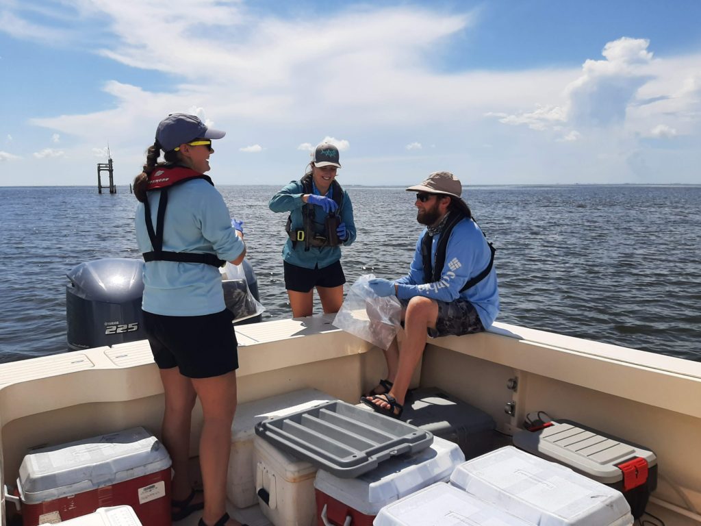
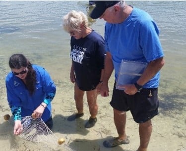
Top: eDNA sampling – Tina Henning, Sam Lucas, and Ethan Bourque
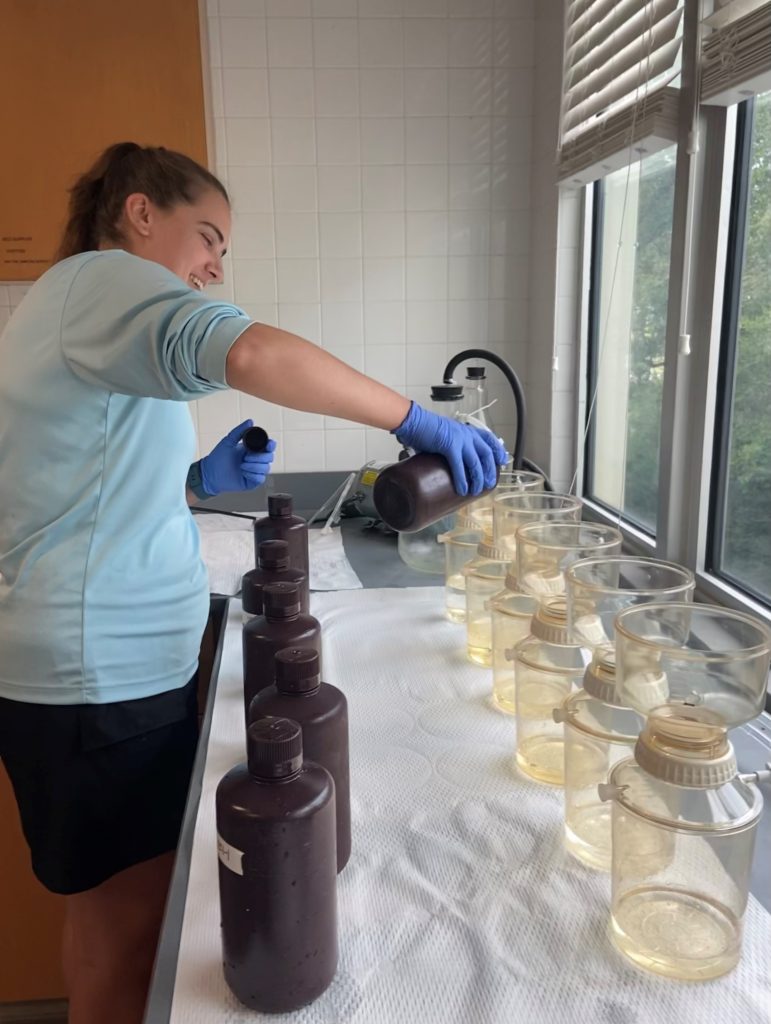
Bottom: eDNA filtering - Tina Henning
eDNA is the genetic material that is naturally shed by organisms in the environment. DNA can be shed by an organism in a variety of ways such as through excrement, mucus, or tissue particles. In this instance, water samples are collected to determine the species of fish present in an estuary. Utilizing this relatively new technology in place of conventional methods such as nets has its advantages. It decreases environmental disturbance, overall costs, and time spent on collection. The goals of the project are to assess fish community and baseline biodiversity in a range of coastal environments while expanding the use and acceptance of eDNA.
Thanks to the University of New Hampshire and Friends of the Reserve, ANERR’s research section had the opportunity to hire a Biological Sampling Intern to assist with the eDNA project. Tina Hennig, who hails from Wisconsin, worked at the Reserve from May to November. Over the course of her six-month internship, Tina assisted with a wide range of field and lab work in addition to the eDNA project. Tina joined the team on water quality trips, nutrient sampling, zooplankton collection, seagrass surveys, trawling, and sea turtle surveys. Tina also spent many hours in the lab processing plankton samples via a FlowCam imaging system and worked on improving the Reserve’s EndNote library. The research section is extremely grateful for Tina’s hard work and dedication over the course of her internship.
Research staff, along with Tina’s help, collected water samples at five sites within the Apalachicola Bay system. The water samples are collected quarterly during the months of February, May, August, and November. Three one-liter bottles are collected at each site as well as a field blank. Once sampling is completed, the one-liter bottles are then transported to and filtered in the Reserve’s lab. Great care is taken to avoid contamination of the samples and/or the filtration equipment.
After each site is filtered, the filter membranes are placed into designated sterilized tubes containing a preservative solution and sent to the University of New Hampshire. At the University of New Hampshire, samples are extracted and analyzed for multiple species. DNA sequences are run through a genetic database and a species list is generated for each site. This list is then checked by site managers for accuracy and adjustments are made as needed.
Three quarters of samples have been collected in 2022 with the next sampling event scheduled for February 2023. Research staff are looking forward to continuing this project in the new year.
